Monday, December 17, 2012

Gladiator generals tomb falls victim to Italys austerity cuts ~ Roman News and Archeology

Gladiator generals tomb falls victim to Italys austerity cuts ~ Roman News and Archeology

On its discovery in 2008, it was hailed as one of the most significant Roman finds in decades. Digging down between the railway line and mechanics' workshops where the Tiber winds its way north out of Rome, archeologists found the remains of a 45ft high structure fronted by four columns. This was what was left of the luxurious tomb of Marcus Nonius Macrinus, the swaggering Roman general whose ceaseless campaigning in the 2nd century helped inspire Russell Crowe's film Gladiator.

GladiatorBut now cuts mean the tomb may be buried all over again, according to Rome's extremely unhappy state superintendent forarchaeology. "I fear we are going to take into serious consideration the idea of protecting these sensational finds by re-covering the entire site with earth," said Mariarosaria Barbera.
Today, Macrinus's last resting place – in an industrial wasteland in the suburbs of Rome – appears forgotten. Delicately carved white capitals which were miraculously preserved for 1,800 years under thick clay now sit, discoloured by air pollution, in pools of rainwater, while cracks caused by winter ice have appeared in the stonework.
With funding for maintenance of Italy's archeological sites slashed by 20% since 2010 thanks to austerity cuts, the €2m-€3m (£1.6m-£2.4m) needed to preserve the tomb will not be available unless a sponsor is found soon, according to Barbera.
Covering up precious discoveries to protect them is getting more common in Italy as funding shrinks, she added. "Until now it has usually happened when remains are not that significant or monumental. In this case they clearly are."
A trusted friend of Emperor Marcus Aurelius, Macrinus won his spurs fighting Germanic tribes, just like Crowe's character, which was enough for the site to be known as "the Gladiator tomb". Beyond that the similarities end, since Macrinus did not fall out with the emperor's son nor become a gladiator but died a rich man, honoured by his massive mausoleum.
"The tomb was very grand, with marble roof tiles, not terracotta, and was probably inspired by what he saw in Turkey," said Daniela Rossi, the archaeologist who led the dig and has written a book about the finds.
A panel carved with Latin script spelling out Macrinus's military career has been dug up, revealing for the first time that he also travelled to Spain.
The discovery also raises new questions about the importance of the Via Flaminia, the Roman consular road running alongside the mausoleum which experts believe was flanked by tombs and rivalled the better known Appian Way.
Exposed by the dig, a stretch of the perfectly preserved, stone-flagged road dating from Rome's republican era abruptly disappears under a suburban railway line at one end of the site and beneath an abandoned graffiti-sprayed house on the other.
"This is an extraordinary site, it blows you away," said Darius Arya, an American archaeologist who has worked at the tomb and is campaigning to keep the bulldozers at bay. "Burying these remains is a disaster – you wonder what is the point of archaeology."
Maria Grazia Vernuccio, a spokeswoman for the heritage group Italia Nostra, said funding cuts were leaving a number of Italian sites at risk of crumbling, from Pompeii to the sprawling city of Ostia Antica near Rome, to Villa Jovis, the Emperor Tiberius's palace on the island of Capri, and Aquileia, the Roman city near Venice.
"Over 40% of Italy's archaeological sites are now closed due to lack of funds," she said. "Inspectors often cannot even get to the more remote sites in their cars because the ministry won't give them petrol and there is less money for guards to keep looters out."
Protected by a rusty padlocked gate, Macrinus's tomb was targeted by thieves after it was first excavated in 2008. "Luckily the piece of marble they selected was too heavy and they dumped it," said Rossi.
Carlo Brecciaroli, the contractor hired to help dig up the tomb and who may now be charged with burying it, warned that work could start any day if temperatures fall and the risk of ice damage increases.
"There are more mausoleums waiting to be revealed along this stretch of the Via Flaminia," said Rossi. "It's a gold mine we may never get to see."

Thursday, December 13, 2012

Hans Christian Andersen’s first fairy tale found


The History Blog » Blog Archive » Hans Christian Andersen’s first fairy tale found

Tunnels under Caracalla Baths open to the public

Tunnels under Caracalla Baths open to the public


Part of the extensive network of tunnels underneath the Baths of Caracalla will open to the public starting December 21st for the first time since their rediscovery in the late 19th century.
Construction on the 11-hectare thermal bath complex probably began under the Emperor Septimus Severus, but it opened in 216 A.D. during the reign of the Emperor Caracalla, hence the name. The baths were free for public use and could accommodate up to 5000 visitors a day. There were open-air gyms (palaestrae), a dry heat sauna and massage room (laconicum), a hot room (caldarium), a warm room (tepidarium), a cold room (frigidarium) and an outdoor Olympic-sized pool for swimming (natatio) that was 164 feet long and just three feet deep.
The swimming pool had no roof and was heated by radiant panels, bronze mirrors angled above to the pool to reflect the sun onto it. The inside rooms and their pools were heated by a hypocaust, an underfloor heating system that channeled hot air from coal and wood-burning furnaces. The closer to the furnace the hotter the room. The water was supplied by a branch of the Aqua Marcia aqueduct called the Aqua Antoniniana built by Caracalla specifically for this purpose. The aqueduct ended in a giant cistern two stories high with 64 vaulted chambers where the water was collected. A series of underground channels carried it from the reservoirs through the hypocaust for heating.
The scale of these baths was so massive the tunnels which ensured its proper operation had to be as well. There are two miles of tunnels along three levels. Each tunnel is 20 feet high and 20 feet wide, wide enough for two ox carts to pass through side by side. Driven by armies of slaves, the carts would transport tons of wood a day to stoke the 50 furnaces.
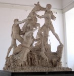
The baths weren’t just for bathing, though. The complex also featured a public library with books in Latin and Greek, all kinds of shops and even conference rooms. The gardens were richly landscaped with plants, water features and sculptures. In fact, the Farnese Pope Paul III ordered the baths be excavated in 1545 with the hope that he could score some quality sculptures for the family collection. His dreams came true and then some. Among the treasures found Farnese Hercules and the Farnese Bull, both now in the National Archaeological Museum of Naples along with the rest of the Farnese sculpture gallery.
Even the tunnels had spaces dedicated to non-bath purposes. The largest Mithraeum in the world was built there. The mystery rites of Mithras were always held in natural caves or in dark underground spaces that resembled caves, and the Baths of Caracalla had room galore along those lines.
The baths remained in use until 537 A.D. when the city was besieged by the Ostrogoths under Witiges who cut off the aqueducts supplying Rome with its water. Since the baths were located at the base of the Aventine close to the southern city walls some distance from the historic center, the baths were left to their own devices during the post-imperial decline of Rome. They decayed into ruin but at least nothing was built over them. Over time people forgot about the complex system of tunnels that had once kept the water running hot; the excavations of the 1500s didn’t go down that far.
The palestrae with their elaborate mosaic floors were rediscovered the first half of the 19th century, and the rest of the complex was revealed over the course of multiple excavations throughout the rest of the 19th century and the first half of the 20th. The tunnels were not as glamorous as the topside finds, however, so even as the baths became a major tourist attraction, the guts of the complex remained off limits to visitors.
Mussolini attempted to strengthen them in the 1930s as part of his plan to use the ruins as a stage for operas. The first summer season opera, Donizetti’s Lucia di Lammermoor, debuted August 1st, 1937, on a stage 72 feet wide, the largest stage in the world at that time, built in the remains of the caldarium. The Rome Opera still puts on a summer season at the Baths of Caracalla to this day, although there was a break between 1940 and 1944 due to war and between 1994 and 2000 due to concerns that the productions were harming the structures. Now the operas are no longer held in the caldarium but rather on the grounds with the majestic remains as a backdrop.
Over the past year, a restoration program has finally paid some overdue attention to the tunnels. The program started inauspiciously with the installation of skylights in the roofs of the tunnels. This turned out to be a bad idea. As soon as the formerly sealed walls were exposed to sunlight and airflow, algae began to make a home for themselves. Within a few months the skylights were closed, the walls cleaned and an electric lighting system installed so tourists can see.
The Mithraeum opened to visitors last month and will remain open until January. There’s little of the decoration left — a partial fresco, the black and white mosaic floor, a piece of a marble altar — but its sheer size is remarkable. The tunnels where restoration is complete will remain open indefinitely. Restoration continues for the rest of the tunnels. The full restoration project is expected to take another two years.
The History Blog » Blog Archive » Tunnels under Caracalla Baths open to the public

Wednesday, December 12, 2012

Classics professor unearths archaeological clues about ancient Roman vineyards ~ Roman News and Archeology

They may not look like much to the untrained eye, but these ancient Roman vine grape seeds, believed to back to the 1st century A.D., could provide “a real breakthrough” in the understanding of the history of Chianti vineyards in the area, de Grummond says.

Roman Vineyards SeedsThis time around it's not the usual shards of pottery and vessels, remnants of building foundations or other unearthed in past years, but rather a treasure that's far more earthy: grape seeds.Actually, Nancy Thomson de Grummond has discovered some 150 waterlogged grape seeds that have some experts in vineyard-grape DNA sequencing very excited.
The tiny grape seeds, unearthed during a dig this past summer in Cetamura del Chianti, were discovered in a well and are probably from about the 1st century A.D., roughly about the time the Romans inhabited what is now Italy's Chianti region. The seeds could provide "a real breakthrough" in the understanding of the history of Chianti vineyards in the area, de Grummond said.
"We don't know a lot about what grapes were grown at that time in the Chianti region," she said. "Studying the grape seeds is important to understanding the evolution of the landscape in Chianti. There's been lots of research in other vineyards but nothing in Chianti."
Clockwise from top left, FSU undergraduates Nat Coombes, Tyler Haynes and Ellie Margedant pose with Professor Nancy Thomson de Grummond, center, and Professor Cheryl Sowder of Jacksonville (Fla.) University, left, at the Cetamura site in Italy.
Nearly every summer since 1983, de Grummond, the M. Lynette Thompson Professor of Classics, has shepherded teams of enthusiastic Florida State students into Italy's Tuscany region to participate in archaeological digs at Cetamura del Chianti, a site once inhabited by the Etruscans and later by .
Over the years, she and her students have unearthed numerous artifacts that have reshaped current knowledge of the religious practices and daily lives of a long-gone people.
De Grummond is a leading scholar on the of the Etruscans, a people whose culture profoundly influenced the ancient Romans and Greeks. Her book "Etruscan Myth, Sacred History, and Legend," the first comprehensive account of Etruscan mythology, was published in 2006. She also co-wrote another book, "The Religion of the Etruscans," with fellow Etruscan scholar Erika Simon; that book was published the same year.
The Etruscans, who once ruled most of the Italian peninsula, were conquered and absorbed by the Romans in the second and first centuries B.C.E. ("Before the Common Era"). Prior to that time, however, they were a highly advanced civilization that constructed roads, buildings and sewer systems and developed the first true cities in Europe. They also built large, complex religious sanctuaries.
De Grummond, who next summer will celebrate her 30th anniversary of taking Florida State students on research trips to Cetamura, said that fellow scholars at the site now include professors who were her former students at FSU. And those professors are now leading their own teams of students.
"We're now getting the 'grand-students,'" de Grummond said—a fond reference to the third generation of researchers she now works with in Cetamura.
Florida State's international archaeological summer program in Italy features field trips to sites and museums that help enrich students' knowledge of the cultures under excavation at Cetamura. It's open to all interested students and is particularly recommended for students majoring in anthropology, art history and classics. Learn more about the program at
De Grummond said researchers in southern France who are compiling a database of vineyard seeds will study the grape seeds from this year's dig.
"It's kind of hard for me as an art historian who studies religion to think that these grape seeds might be my finest hour," de Grummond said with a laugh. "But they might be."

Classics professor unearths archaeological clues about ancient Roman vineyards ~ Roman News and Archeology

Ostie: Le premier port antique de Rome enfin retrouvé ~ Roman News and Archeology

Ostie: Le premier port antique de Rome enfin retrouvé ~ Roman News and Archeology
According to the ancient texts, Ostia was founded by Ancus Marcius, the fourth King of Rome. The goal was threefold: give Rome a led to the sea, ensure its supplies of wheat and salt and finally, to prevent an enemy fleet up the River Tiber. Archaeological excavations have shown that the initial urban core (castrum) back at the earliest at the turn of the 4th s. and 3rd s BC.
If large ancient buildings and the main roads have been gradually updated, the location of the river port of Ostia mouth remained unknown so far. For some, it was seen as a port lost forever. Indeed, since the Renaissance, many attempts to location of the port of Ostia were undertaken, without success. It was not until the 19th and 20th century that Italian archaeologists define an area to the Northwest of the city, near the Imperial Palace. At the beginning of the 21st century, archaeologists confirm the probable location of the basin in the northern sector, using geomagnetic instruments. But there is still no consensus on the exact location of the port and the debate remained bright.
A Franco-Italian team led by Jean-Philippe Goiran, researcher at the Archeorient Laboratory (CNRS / Université Lumière Lyon 2), so tried to permanently testing the hypothesis of a port in the North with a new geological cores. With the latest technological advances, this enables to overcome the problem of the table water that prevented traditional archaeological excavations down beyond 2 m depth.The sediment cores obtained helped to update the complete stratigraphy at a depth of 12 m and an evolution in 3 steps:
1. Layer deep, prior to the foundation of Ostia, indicates that the sea was present in the area at the beginning of the 1st millennium BC.
2. Stratum median, rich in clay-silty sediments of grey colour, which characterizes a port facies. The calculations give a depth of 6 m to the pool at the beginning of its operation, dated between the 4th and 2nd century b.c. Regarded until then as a primarily river port, which can accommodate shallow draft boats, the port of Ostia was in reality a deep pool to accommodate large marine vessels; This is what showed the depth measurement.
Mockeries, the most recent layer testifies to the abandonment of the basin in Imperial Roman times by massive accumulations of silt. With radiocarbon dates, it is possible to deduce that a succession of episodes of major floods of the Tiber River came to permanently seal the harbour basin of Ostia from the 2nd century BC BC to the first quarter of a century a.d. (and this, despite possible phases of cleaning). At that time, the depth of the basin is less than 1 m and makes all navigation impossible. These results are consistent with the speech from the geographer Strabo (58 BC – 21/25 ad) that indicates a filling of the port of Ostia by sediments of the Tiber at its time. It was then abandoned in favour of a new port complex built 3 km north of the mouth of the Tiber River, the name of Portus.
This discovery of the harbour basin of mouth in Ostia, North of the city and to the West of the Imperial Palace, will allow to better understand the relationship between Ostia, its port and the creation ex-nihilo Portus, started in 42 BC and completed under Nero in 64 a.d. This gigantic port of 200 ha will then become the port of Rome, and the largest ever built by the Romans in the Mediterranean.
Between the abandonment of the port of Ostia and Portus construction operations, the researchers estimate that nearly 25 years have passed. How Rome, capital of the world ancient and first city to reach a million people, was fed in wheat during this period? The question arises now researchers.

Thursday, November 29, 2012

The Lost Town of Dunwich located in Dunwich, United Kingdom

The Lost Town of Dunwich located in Dunwich, United Kingdom | Atlas Obscura | Curious and Wondrous Travel Destinations
The Lost Town of Dunwich
Dunwich is a village on the east coast of England that has almost completely eroded into the North Sea.
Image of The Lost Town of Dunwich located in Dunwich, United Kingdom | Heritage House. undated. "Ordnance Survey Scale Linked Map of Dunwich and the Lost City 
(with Walberswick to Minsmere Walks)." Bradfield, Manningtree: Heritage House.
Heritage House. undated. "Ordnance Survey Scale Linked Map of Dunwich and the Lost City (with Walberswick to Minsmere Walks)." Bradfield, Manningtree: Heritage House.
Image of The Lost Town of Dunwich located in Dunwich, United Kingdom | Ruins of Greyfriars' Monastery. Author's photo.Image of The Lost Town of Dunwich located in Dunwich, United Kingdom | Heritage House. undated. "Ordnance Survey Scale Linked Map of Dunwich and the Lost City 
(with Walberswick to Minsmere Walks)." Bradfield, Manningtree: Heritage House.
Intriguing Environs http://atlasobscura.com/category/intriguing-environs Ghost Towns http://atlasobscura.com/category/intriguing-environs/ghost-towns Incredible Ruins http://atlasobscura.com/category/architectural-oddities/incredible-ruins Subterranean Sites http://atlasobscura.com/category/architectural-oddities/subterranean-sites
Formerly the early medieval capital of East Anglia, Dunwich is now a small village that over the past eight centuries has been suffering from coastal erosion. Today it is no larger than a few streets, a pub, and a few houses. And, famously, the Flora Tea Rooms, an excellent fish-and-chip shop.
Most of the former town lies underneath the waves, as the local museum demonstrates, and the town has made an industry out of its lost heritage (which included around a dozen churches, a market square, and a guildhall). Walking along the shingle beach it is frequently possible to pick up small artefacts and bits of archaeology (including bones from an eroding cemetery) from the crumbling cliffs overhead.
Once a prosperous seaport with a population of 3000 and listed in the Domesday book, the town was largely destroyed by storms in 1286 and 1347, then fell further victim to the eroding coastline. Today, almost the entire town has disappeared, leaving only the remains of a couple of buildings.
Ruins of Greyfriars' Monastery are a striking part of the landscape, but most affecting is the palpable sense of absence to the village, and the realization that within another century, it may well disappear for good.